- Plants
- ›Vascular Plants
- ›flowering plants
- ›monocots
- ›Agaves, Orchids, Irises, and Allies
- ›Orchids
- ›Orchidoid Orchids
- ›Diurideae
- ›Diuridinae
- ›Diuris
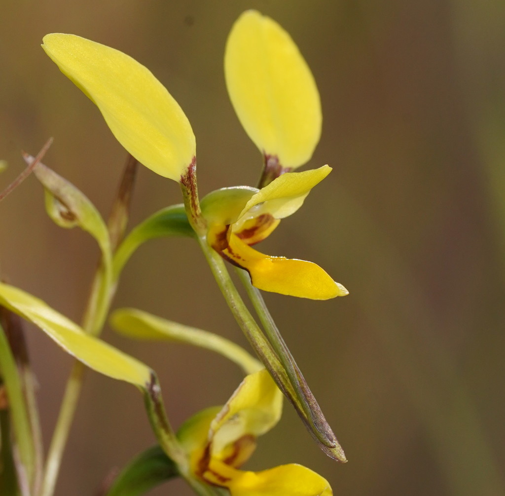
northern donkey orchid
Diuris luteola
Diuris luteola, commonly called the northern doubletail, is a species of orchid which is endemic to Queensland. It has a single linear leaf at its base and up to six pale yellow flowers with a few brown markings. It grows in shallow, stony soil on tablelands in eastern parts of the state.
From the article Diuris luteola on Wikipedia (CC BY-SA), quoted section by section
Description
Diuris luteola is a tuberous, perennial herb with a single linear leaf 200–350 mm (8–10 in) long, 3–4 mm (0.1–0.2 in) wide with a purplish base. Up to six pale yellow flowers with a few brown markings, about 25 mm (1 in) wide are borne on a flowering stem 120–450 mm (5–20 in) tall. The dorsal sepal projects forward and is egg-shaped, 7–10 mm (0.3–0.4 in) long and 5–8 mm (0.2–0.3 in) wide. The lateral sepals are linear to lance-shaped with the narrower end towards the base, green with brown blotches, 12–20 mm (0.5–0.8 in) long, about 2 mm (0.08 in) wide, turned downwards and crossed over each other. The petals are more or less erect, spread apart from each other with an elliptic to egg-shaped blade with the narrower end towards the base. They are 6–10 mm (0.2–0.4 in) long and 4.5–8.5 mm (0.2–0.3 in) wide on a dark reddish brown stalk 3–5 mm (0.12–0.20 in) long. The labellum is 6–9 mm (0.2–0.4 in) long, usually projects forwards and has three lobes. The centre lobe is linear to egg-shaped, 4–7 mm (0.2–0.3 in) wide with a few pale brown markings. The side lobes are linear to oblong, erect, about 3 mm (0.1 in) long and 1–1.5 mm (0.04–0.06 in) wide. There are two parallel ridge-like calli about 5 mm (0.20 in) long near the base of the mid-line of the base of the labellum. Flowering occurs from July to September.
Range & habitat
The northern doubletail grows in shallow soil in grassy forest from Mount Windsor adjacent to the Daintree National Park to the Blackdown Tableland.
Wikipedia: “Distribution and habitat”
Where it lives
Recorded sightings
—
geo-referenced records in GBIF, from museums, herbaria and field observers.
Drag the globe to turn it. Dots are where records exist, not a range map; darker means more records.
In the stacks
Searching the stacks…
Every page naming Diuris luteola in the Biodiversity Heritage Library →
This page is assembled live from iNaturalist, GBIF, Wikipedia, the Source Library and the Internet Archive. It is not yet part of the hand-edited codex. iNaturalist taxon 829502.